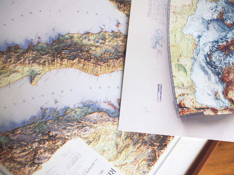
Hello map enthusiasts and intrepid explorers! Welcome to the inaugural post of the VizArt blog.
Today we’re diving into the world of cartography with Leonardo, co-founder of VizArt, as he shares his top 5 favorite maps. Selecting just five was no easy task, so for now, let’s do it easy and consider them all equally fantastic. We’ll rank them in the future, promise.
Our journey begins with a vibrant geological map of Grossglockner, Austria. Published by G. Freytag and Berndt in 1939, this map captivates with its stark color contrasts between geological units and the white of glaciers. Intrigued? Feast your eyes on the image below.
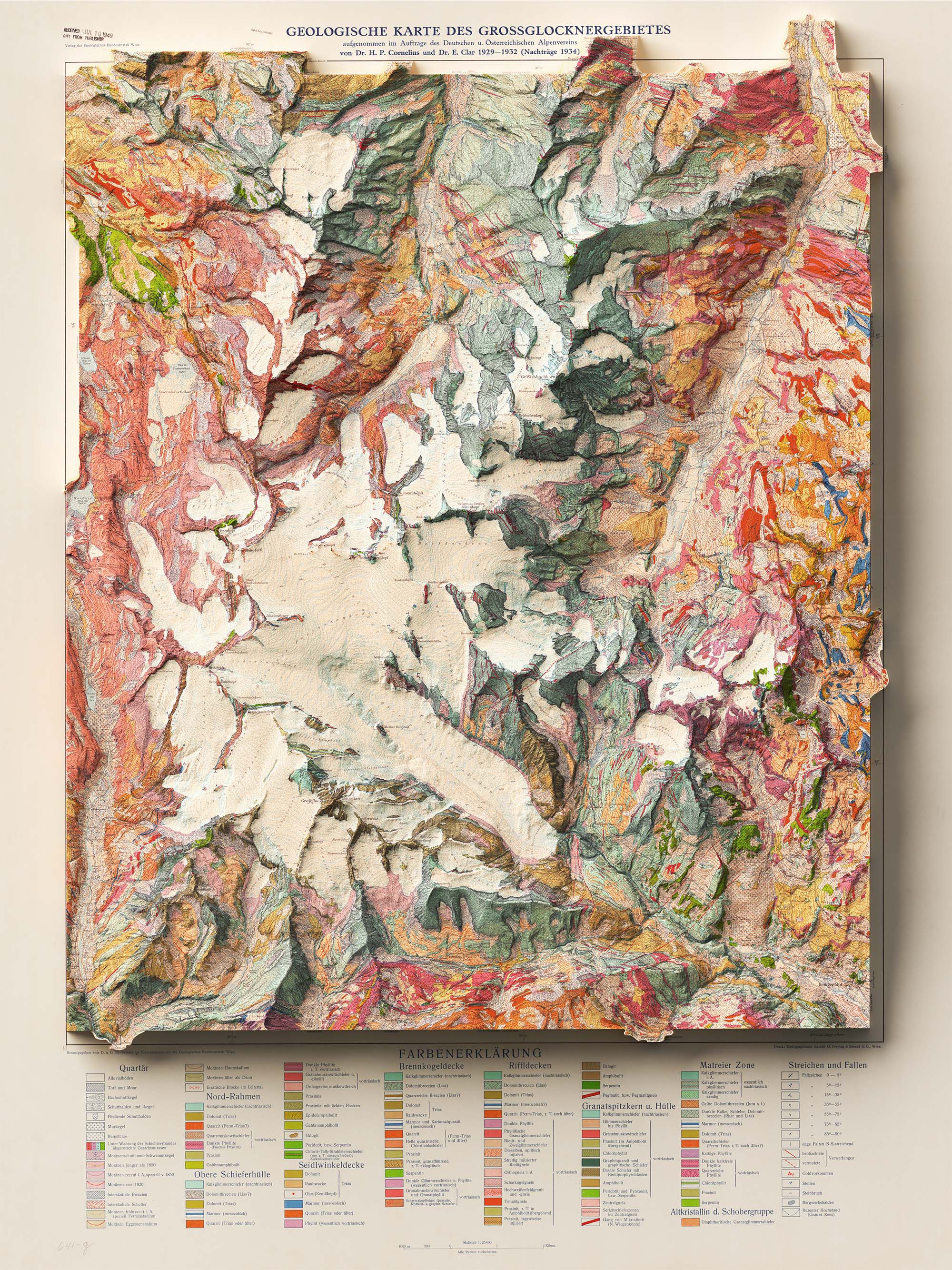
If you want to learn more about it explore the product page here.
Okay, good job Leonardo. Now the second one. Next up is a recent addition that quickly climbed the ranks fro me. It is a topographic map of Indonesia, prepared by Topographisch Bureau and published in the Atlas van Nederlandsch Oost-Indië in 1901. With is minimalism is a testament to the beauty of simplicity. Its predominantly white palette, accentuated with subtle shades, is a style I’ve grown to love.
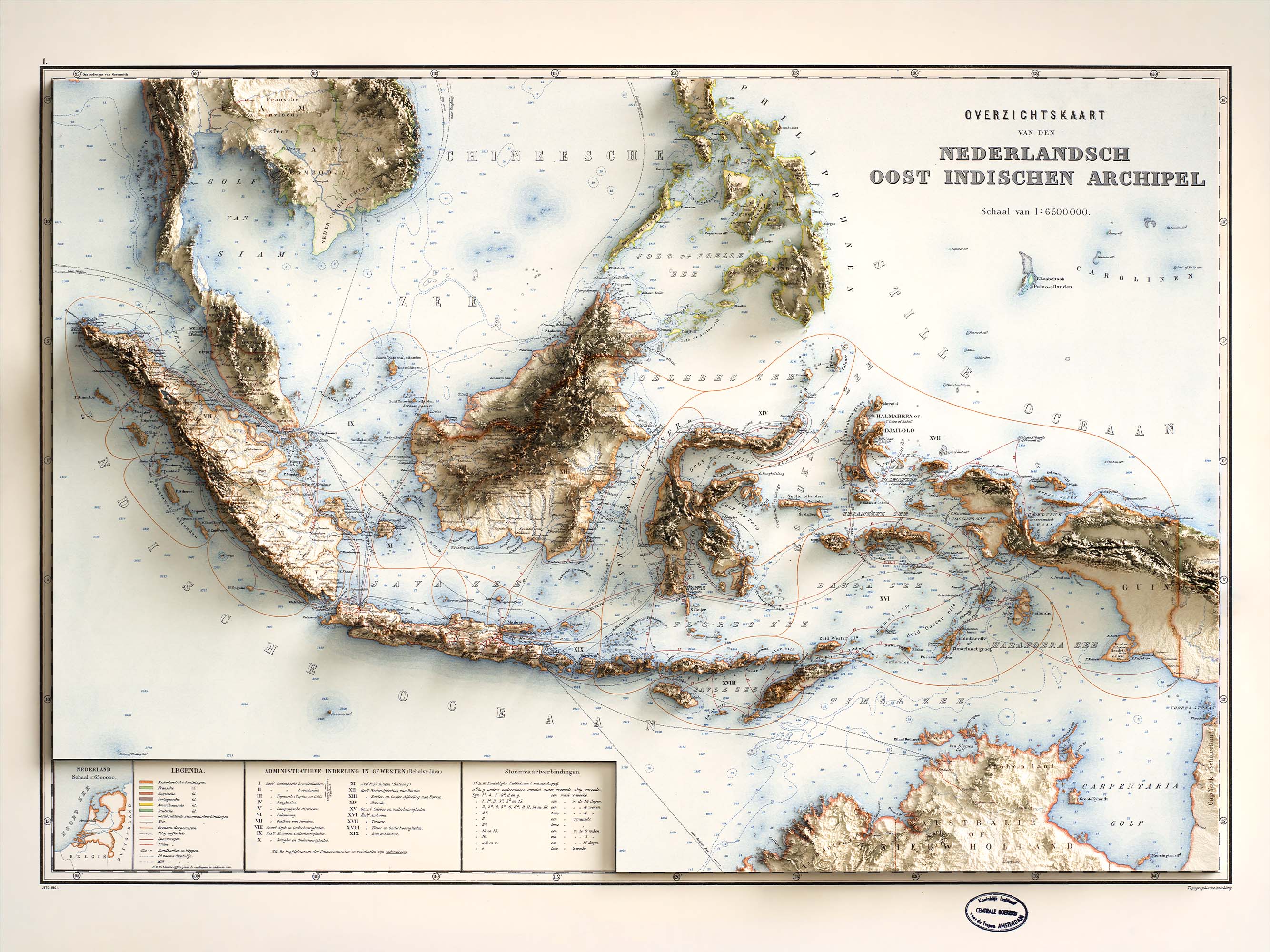
What a beauty! Find some useful information here.
Two done, three more to come. This map has been with us almost from the beginning. Originally a custom map, it was later added to our shop due to its undeniable appeal. The Steigen topographic map, prepared and published by Norges Geografiske Oppmåling in 1902, takes minimalism to new heights. I made you curious?! Let's see it!
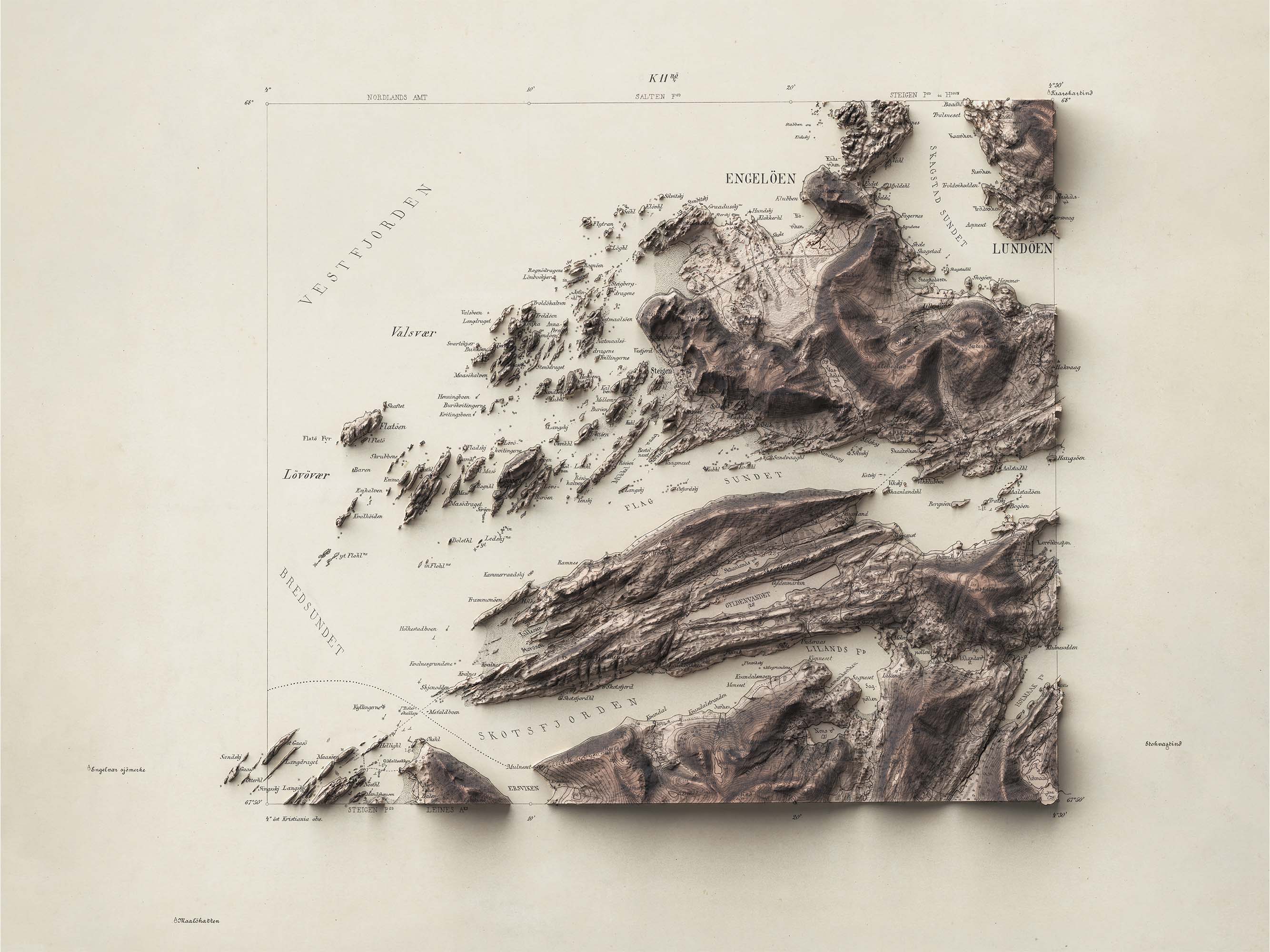
Gorgeous! Just one color and contours line to give a bit of deepness. Find it at our product page here.
Go with another one. My fourth map is a recent creation that quickly made it to my top 5. The Tuscany topographic map, prepared and published by Istituto geografico militare in 1935, enchants with its harmonious color palette achieved through the shaded relief effect.
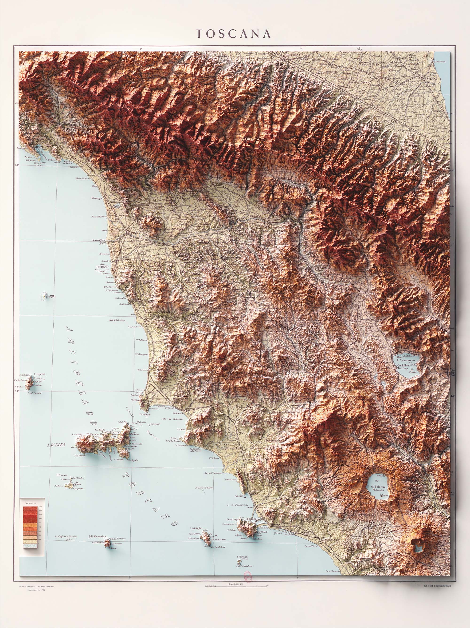
It gives off a sense of warmth and coziness, doesn't it? So relaxing! Get more info at our product page here.
Last for today! This one is the most hard one. Go with a topographic map of Mount Rainier, Washington State (USA). From the Quadrangle series map, prepared and published by U.S. Geological Survey in 1971. It is only the West side.
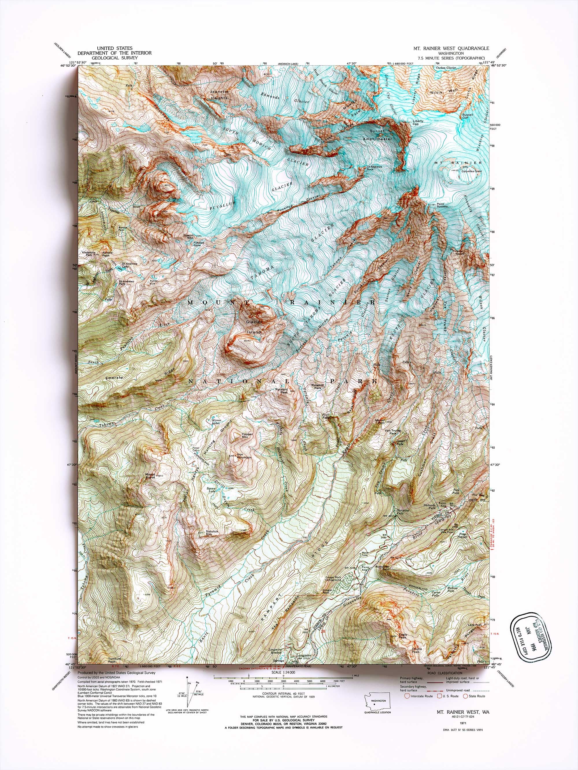
Only three colors and contours lines. What a great example of cartography! Check it out the Rainier map at our product page here.
That’s it for today! I hope you enjoyed this journey through my top 5 shaded relief maps. Now, it’s your turn! Explore our store, find your favorites, and let us know your top picks. Can’t find what you’re looking for? Visit our request page to learn more about our custom map service.
Comments (0)
There are no comments for this article. Be the first one to leave a message!