
Greetings to all map lovers and Italy enthusiasts! Today, I’m thrilled to showcase some of our most enchanting Italian maps available on VizCart Shop. These maps not only provide a comprehensive and historical view of Italy since the 1900s, but they also serve as artistic masterpieces that infuse any space with a touch of elegance.
Ready for a journey through time?
Let’s embark!
1922 Topographic Map of Italy
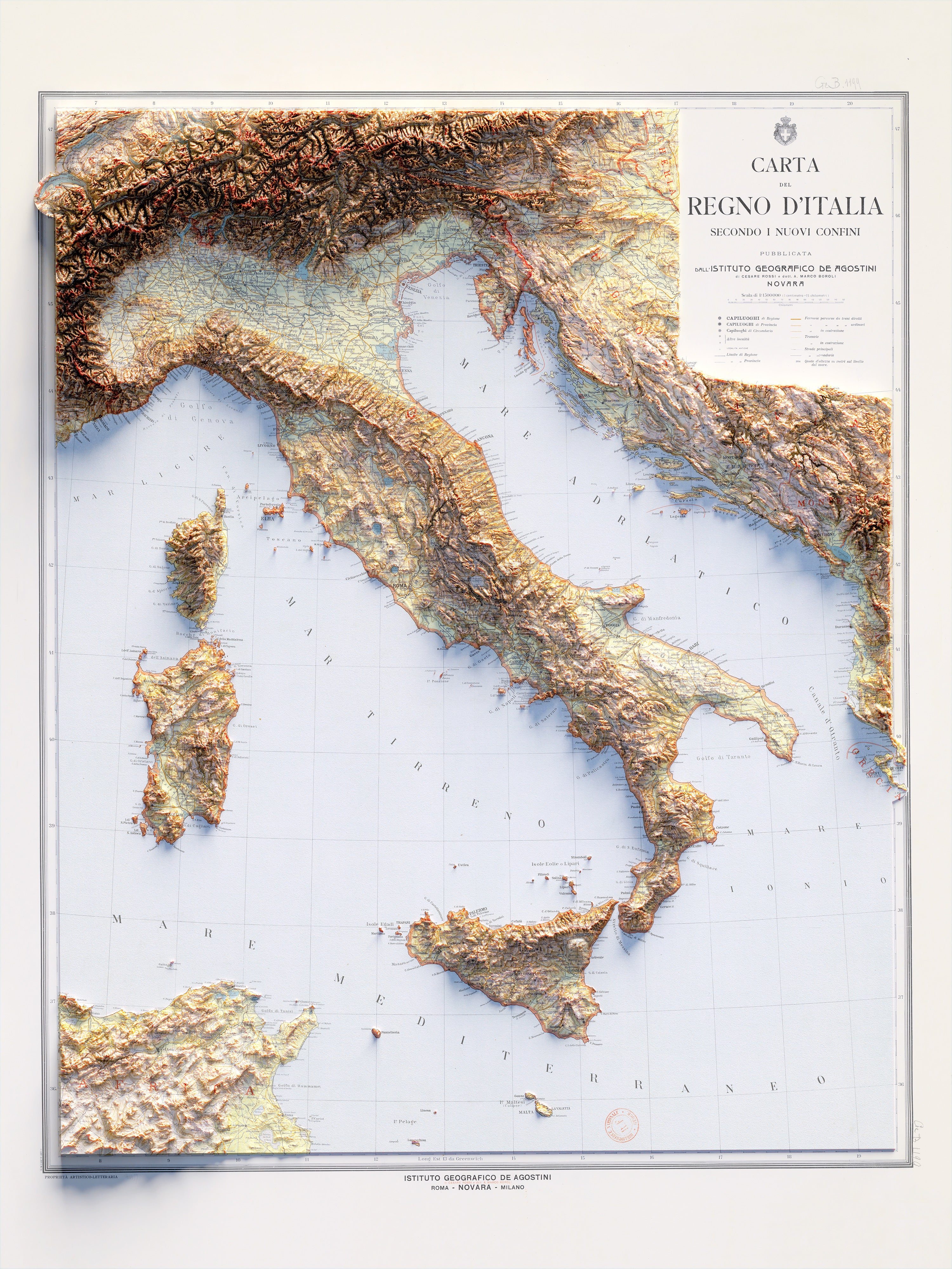
Our 1922 topographic map of Italy is a genuine gem. Crafted and published by the esteemed Istituto Geografico De Agostini, this map presents a detailed depiction of the Kingdom of Italy at the dawn of the 20th century. Established in 1901 by the geographer Giovanni De Agostini, the institute boasts a rich legacy of producing top-tier geographical materials. This map illustrates the terrain variations and geographical nuances with a distinctive artistic flair. The map features light tones, subtle saturation, and a more natural color palette, making it an ideal choice for those who appreciate a softer, vintage aesthetic. A key highlight of this map is its ability to showcase the differences in the country’s borders between the Kingdom of Italy in 1922 and Italy today. Intriguing, isn’t it?
1967 Topographic Map of Italy
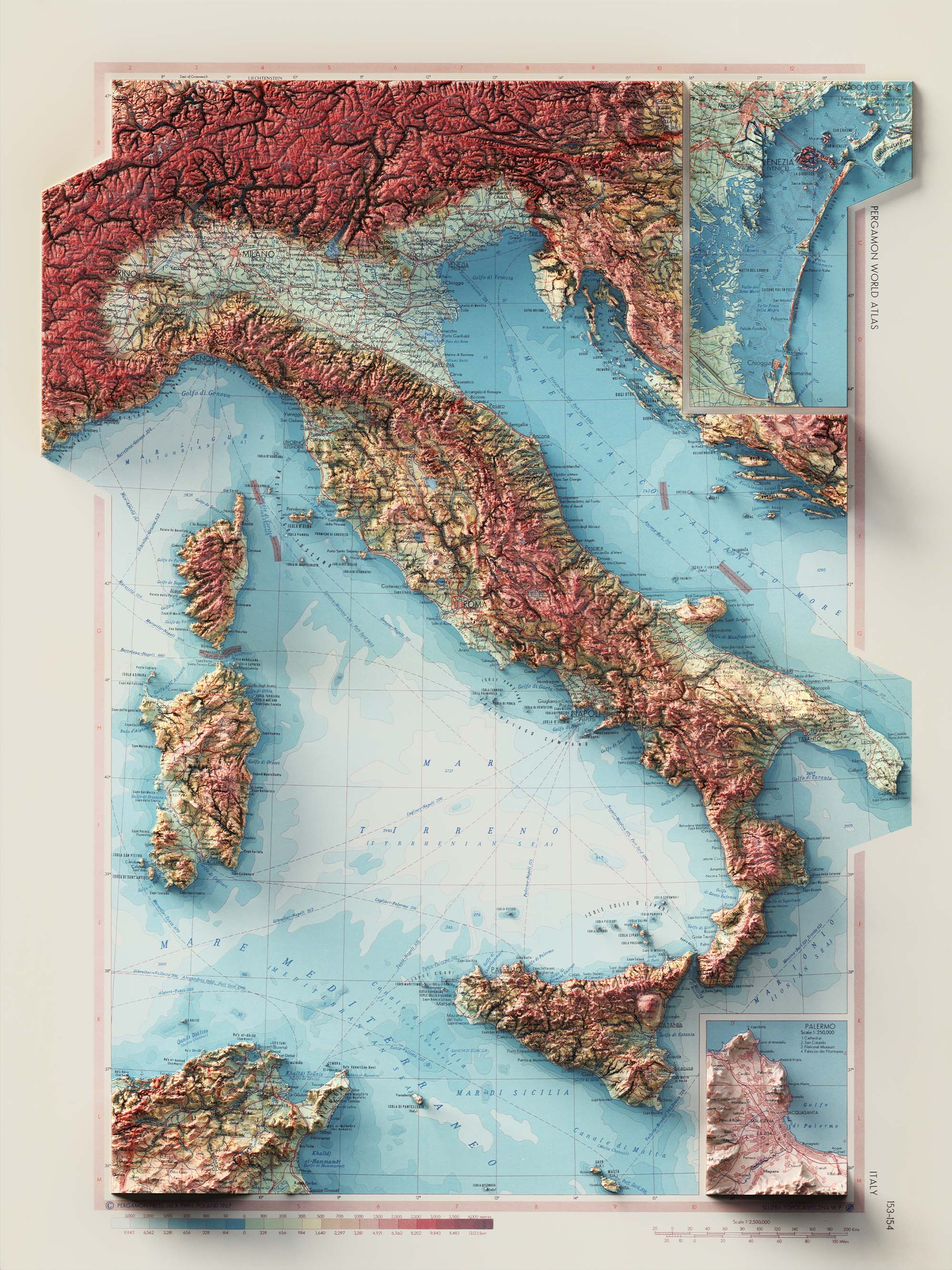
Transitioning to the 1967 topographic map of Italy, we encounter a contrasting perspective. This map, prepared by the Polish Army Topographical Service, is a part of the Pergamon World Atlas (Atlas Swiata), one of the largest atlases globally (weighing nearly 5.5 kilograms and encompassing 48 square meters of maps). The map exhibits harder lines and higher contrasts, with the Alps and the Apennines appearing majestic. The warm colors and greater saturation lend it a bold and striking appearance.
1936 City Map of Florence
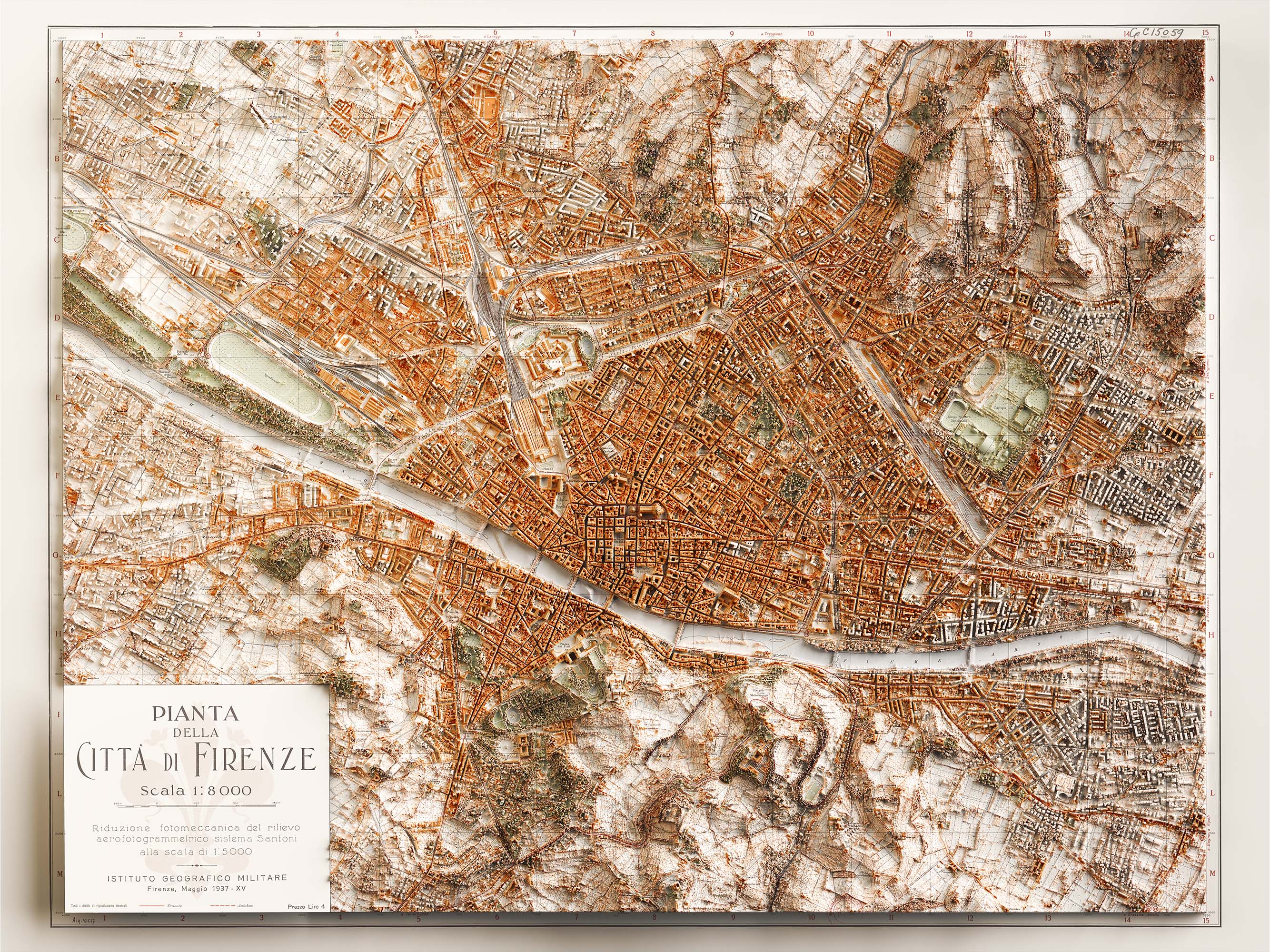
For urban explorers, we present the 1936 city map of Florence. This intricate map, produced and published by the Istituto Geografico Militare, an Italian public organization serving as the national mapping agency for Italy, unveils the allure of Florence, with its historical monuments and labyrinthine streets. Established by King Vittorio Emanuele II in 1861, the institute has been instrumental in producing a significant portion of Italy’s national cartography. The map’s primary feature is its ability to illustrate how the city has evolved, thanks to the contrast between the original map and the relief of the buildings that we have added. The peripheral part of the city in the map is represented by mere countryside, while in the added relief, it is evident that it is now a fully developed area. Interestingly, the historical center of the city aligns perfectly between the current relief and the original map, underscoring how an ancient city like Florence has remained unchanged in its historic center over the last 100 years.
1935 Topographic Map of Tuscany
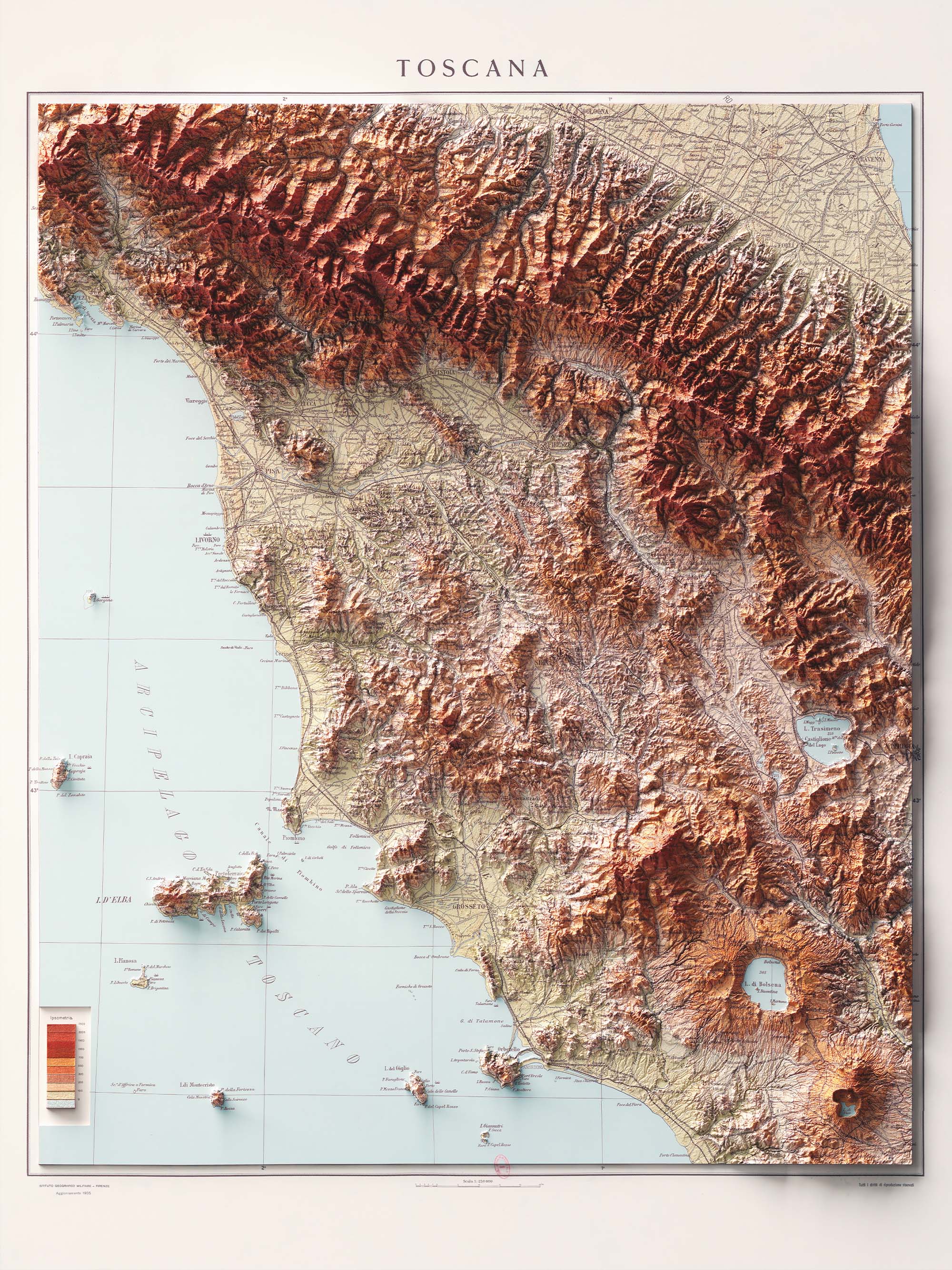
Lastly, our 1935 topographic map of Tuscany offers a comprehensive view of this captivating region. This map, also produced and published by the Istituto Geografico Militare, captures the beauty of Tuscany with its vineyards, hills, and historical cities. The map features warm colors that echo the typical hues of the Tuscan hills. A valuable addition is the volcanic lakes of northern Lazio that surround the southern part of the region. The reliefs make it evident that they are calderas of former volcanoes. Bolsena, Vico. Simply stunning!
We hope you enjoy these maps as much as we do. We eagerly look forward to helping you discover more maps from the VizCart shop. Perhaps our next post will be devoted to the Italian islands. In this regard, we’re excited to announce that we’re working on two new geological maps: Stromboli and Vulcano (Aeolian Islands). We hope they’ll be ready for our next post dedicated to islands.
Happy mapping and time traveling with our vintage maps!
Comments (0)
There are no comments for this article. Be the first one to leave a message!